
 Български
 Català
 Čeština
 Dansk
Dansk Deutsch
 Ελληνικά
 Español
 Eesti
Eesti Suomi
Suomi Français
 Gaeilge
 Hrvatski
 Magyar
 Italiano
 Lietuvių
 Latviešu
 Malti
Malti Nederlands
 Norsk
Norsk Polski
 Português
 Română
 Русский
 Slovenčina
 Slovenščina
 Srpski
 Svenska
 Türkçe
 Українська
Truck navigation built by someone who is still driving
Most truck sat-navs are built by companies. This one is built by a driver who is out on the road every week, meets the same low bridges and narrow lanes you do, and fixes them the same evening.
Already a tester? Get the latest version on Google Play →
Free while in testing · The UK, Ireland, every EU country, Norway and Switzerland · Built for an Android tablet
The problem
You already know it
You put your height and weight into the sat-nav. It still sends you under a low bridge.
You take a wrong turn. It spends three miles telling you to turn round instead of finding a new way.
It puts you down a single-track lane, and you get out to snap branches off a tree to get through.
You report it. Nothing changes. Two years later it is still wrong.
Every truck sat-nav on the market has the same weakness, and it is not a software problem. It is a data problem. The map does not know which roads a lorry can actually get down — and the people who do know are sitting in the cab, with no way to tell it.
LorryMate is built the other way round.
Done differently
Three things
You can fix the map yourself
Sent down a road that is too narrow? Press Street unsuitable, pick a reason, and the route recalculates on the spot. That road stays marked for you from then on. Found a turn your lorry will not make? Press Avoid, and it routes round it. No forms, no waiting for someone in an office to agree with you.
Every restriction has a source and a date
When LorryMate shows a bridge height, it also knows where that number came from and when. Where a database and the sign on the bridge disagree, the sign wins. If you spot a height that is wrong, email me and I correct the map by hand. Where nothing is confirmed, it says so rather than guessing.
Your exact vehicle, not the nearest guess
Save every lorry you drive by name, with its real height, width, length and weight. Switch between them in two taps when you change vehicle mid-shift. The routing profile is worked out from those measurements, so it cannot drift out of step with them.
Today
What it does
- Turn-by-turn navigation in 3D, with day and night modes
- Every vehicle profile — rigid, artic, van, motorhome, bus, tractor, car — each with your real dimensions
- Several vehicles saved, switched in seconds
- Turn restrictions honoured — banned manoeuvres are read from the map, not ignored
- Avoid a turn your vehicle physically cannot make, and get a route round it
- Mark a street unsuitable and never be sent down it again
- Restriction layers on the map — low bridges, weight and width limits, lorry parking, fuel. Filter to what is on your route, within a mile, or across the whole screen
- Private and delivery-access roads included, so it takes you to the customer's door and not to the end of their lane
- “Except for access” roads flagged before you set off, so you decide whether to use them rather than being routed round a restriction that does not apply to a delivery
- Ferry crossings included — the Isle of Wight, the Lymington crossing, and Holyhead to Dublin all plan as one route, boat and all
- A satellite photo of the place you are going, dropped onto the map as a window — so an unfamiliar yard is something you have already looked at before you turn into it
- Sharp turns flagged before you reach them — the angle and the distance, with a button to route round it. A 156° turn is a reverse in an artic, and you want to know about it earlier than the junction
- Other roads to choose from — press OTHER ROUTES and the alternatives are drawn in pale blue; tap one and that is the road it takes you. Needs a signal, and is offered up to 150 km
- A day of drops in one route — mark a point Via and it takes you through it without announcing an arrival; hold a finger on the map mid-drive to add a stop where it fits along the way; STOPS 2/5 shows where you are and lets you Skip a cancelled drop without stopping the navigation
- Nearest fuel, parking and food with no signal — type “fuel” or “Shell” and get the closest by distance. Lorry parks confirmed for HGVs come first; the rest are marked unchecked
- Working time next to driving time — a WORK button tracks the day, breaks and hours since the last break, with a warning at 5½ and 6 hours. The tachograph stays the legal record
- Share a place from Google Maps straight into LorryMate. A pinned point arrives exactly. A business listing — a filling station, a shop, a yard — is matched to its building from LorryMate’s own map data; if there is no match it goes to the centre of the postcode, and the screen says postcode centre — approximate. Short links need a signal
- Watch the whole run before you leave — press PREVIEW and it drives the route at speed on screen, like the old TomToms did
- Screen and voice in 26 languages, including Lithuanian, Polish, Romanian, Russian and Ukrainian
- It never goes quiet — if a route cannot be found, it says exactly why and how far away the problem is
Not yet
What it does not do
I would rather you knew now than found out on a job.
- Planning a route from one area into another needs a signal. Hampshire to Vilnius plans fine, but the joining-up is done on my server. Inside one area the tablet does it alone. Stops can only be added within one area: a route into another area goes straight from start to destination.
- Searching for a new address needs a signal. Places you have already saved — including house names you added yourself — are found with no signal at all.
- Live traffic is new and still on trial. A layer showing where traffic is slower than usual has just been added for testers, and it needs a signal. Until it has proved itself, keep Google Maps running alongside. So do I. In the UK, roadworks and road closures from Street Manager are shown.
- Lane guidance is new and has not been driven much. Before a junction or roundabout the app can now show which lane to take, when it has a signal. It has been checked on a handful of roads, not across the country. If the screen and the road markings disagree, the road markings are right.
- No Android Auto or CarPlay. It runs on a tablet in the cab.
Everything on this list is being worked on. Nothing on it will be quietly dropped and never mentioned again.
Coverage
Where it works right now
The United Kingdom and Ireland, every EU country, Norway and Switzerland. Each area has three downloads — the map, the routing file, and a pack of road signs, fuel stations, shops and parking — and once they are on the tablet it draws the map and works out routes with no signal.
| Area | Map | Routes | Signs, fuel & parking |
|---|---|---|---|
| United Kingdom & Ireland | 2.1 GB | 510 MB | 44 MB |
| France | 3.7 GB | 872 MB | 55 MB |
| Spain & Portugal | 1.7 GB | 645 MB | 27 MB |
| Germany | 3.3 GB | 864 MB | 69 MB |
| Belgium, Netherlands & Luxembourg | 1.2 GB | 184 MB | 19 MB |
| Switzerland & Liechtenstein | 368 MB | 108 MB | 8 MB |
| Austria | 643 MB | 185 MB | 9 MB |
| Italy & Malta | 1.8 GB | 519 MB | 38 MB |
| Czechia | 688 MB | 113 MB | 9 MB |
| Poland | 1.8 GB | 340 MB | 31 MB |
| Slovenia, Croatia, Hungary & Slovakia | 1.1 GB | 240 MB | 13 MB |
| Romania, Bulgaria & Greece | 1.2 GB | 349 MB | 13 MB |
| Denmark, Sweden & Norway | 3.8 GB | 424 MB | 20 MB |
| Finland | 1.2 GB | 173 MB | 5 MB |
| Lithuania, Latvia & Estonia | 682 MB | 97 MB | 5 MB |
| Cyprus | 39 MB | 17 MB | 4 MB |
Address search now covers the whole of Europe. Anywhere in Europe. Edinburgh, Belfast, Lisbon, Riga, Paris, Nicosia: all found, street and postcode.
Routes cross borders. Hampshire to Vilnius plans as one route, ferry and all. Inside one area the tablet works the route out by itself; a route from one area into another is joined up on my server, so it needs a signal when you plan it, and again if it has to be recalculated. Stops can be added within one area; a route into another area goes straight from start to destination.
Download before you leave home. The sizes are in the table — the map is the big one. Over Wi-Fi the app now fetches the routing file and the signs pack for the country you are in by itself. This list changes as areas are built, so it is worth re-reading before a trip.
Bridge and restriction data now covers the whole of Britain. Until September it stopped at Hampshire, Dorset and the Isle of Wight. It is a separate 24 MB download next to the Britain map: 25,395 bridge heights, 35,527 weight limits, 16,559 level crossings. Checked in six cities from London to Glasgow. Without that download the app falls back on the small Hampshire set built into it — so download it before you leave home. It is only as good as the data it was built from: the sign at the bridge still wins.
In the cab
What it looks like
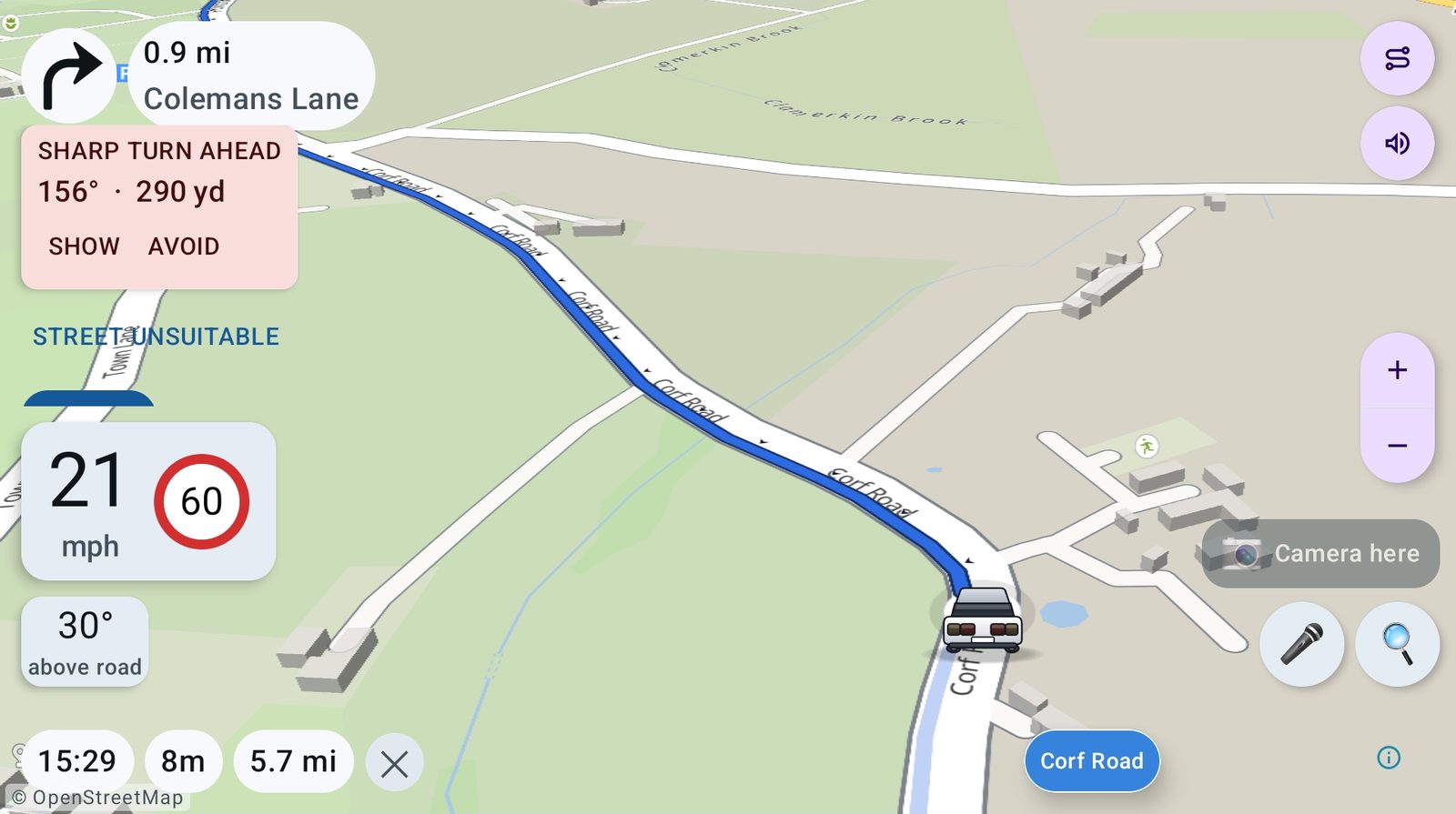
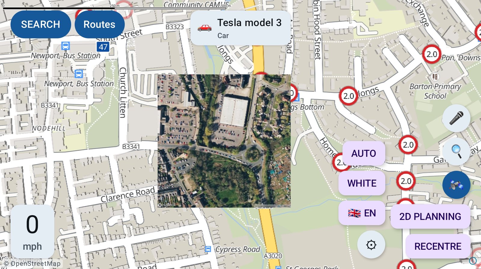
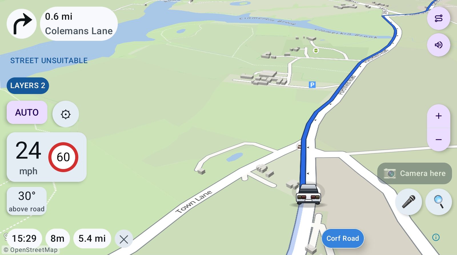
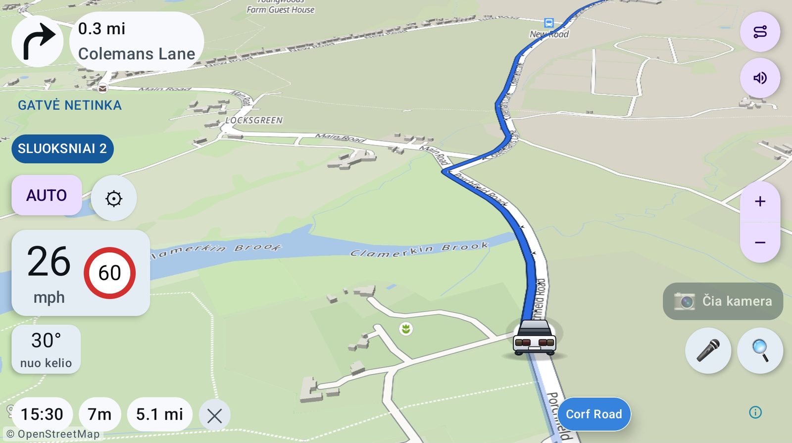
Real screenshots from a tablet on the road, taken this week. Nothing here is a mock-up or a render.
Testing
Try it
LorryMate is in testing. It is free to use while it is, and everything you report goes straight to the person who wrote the code.
Already a tester? Get the latest version on Google Play →
Testers install it and get updates from Google Play. The APK from this website works too — your tablet will ask you to allow the install. Here is how. When it is on, the driver's guide walks you through it one screen at a time, and the questions page covers what usually goes wrong.
What I need back from you
Nothing formal. When something goes wrong, tell me:
- Where you were and where you were going
- Which vehicle you had selected
- What it did, and what it should have done
A photo of the screen is worth more than a paragraph.